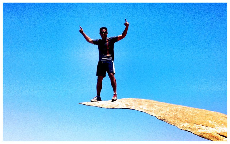
Mt. Woodson Hike
Setting out for a late morning hike with Joyce O. and Greg J., we would find out early on that it was going to be a very hot hike up the local mountain. Looking up some details the night before on San Diego Hikers, details included a difficulty of 6/10 and a length of approximately 8.0 miles there and back. Browsing the Lake Poway Trails website also provided some good details. Driving into Lake Poway, I was surprised there wasn't a parking charge (which usually costs $5) and we made our way to the right hand side of the park as far south and east as possible parking as close as possible to the trailhead. I parked the car in a good shaded area and then applied some sunscreen while waiting for Greg.
We set out right away and the uphill began. We would take breaks here and there and I noticed that I was drinking too much as my Nalgene bottle was only a quarter full when I got to the top. I ended up jogging the last 1.3 miles and came to the idea that I'd like to do this again as a "trail run," sometime. The bottom line and goal of this hike was really all about the photo op. I mean, seriously...it's just something to have posted on facebook or my website right? The picture is misleading but looks awesome. You'll have to hike it to find out what I'm talking about.

Not only was this trail a great hike, I remembered to bring my Garmin Edge 500 and have the data embedded below! If you check it out, the uphill battle was definitely much more of a workout compared to the downhill portion. With that, I've come to the realization that going downhill sucks. It's hard on my knees and isn't as much fun.
From Lake Poway to Mt. Woodson and back! Here's the Garmin Connect Data!